Email is best (search-for that "email" address below), "info" at this domain will work.
Please send us your Phone number if you wish to talk/ask-questions/clarifications.

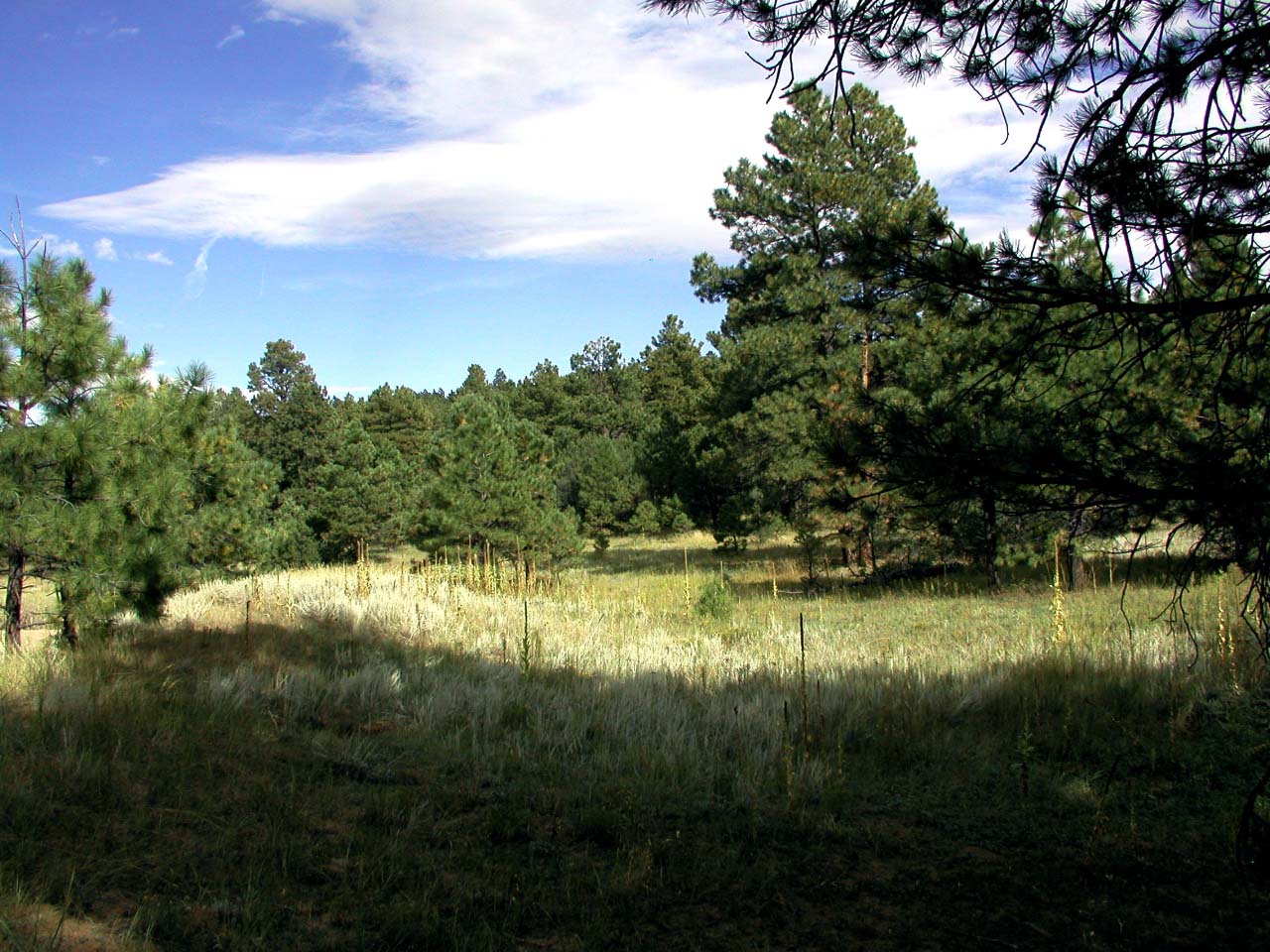
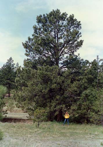
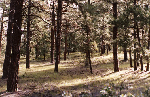
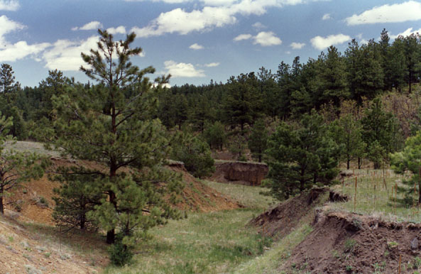
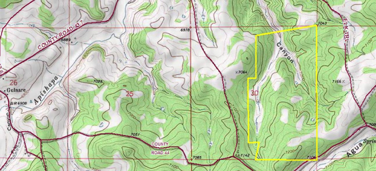
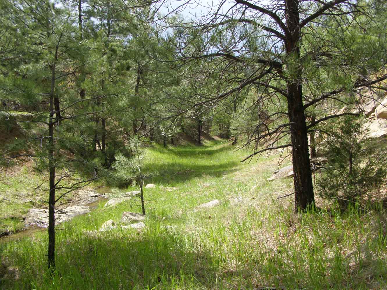
264+ acres of beautiful ponderosa pine forest, meadows, rock formations, mountain
views, plentiful wildlife, well over a half a square mile of your own national forest quality ranch land.


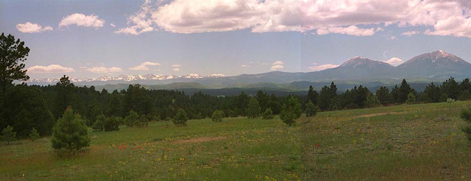
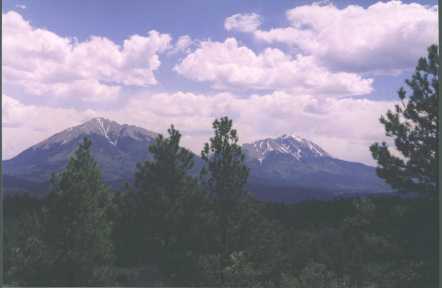
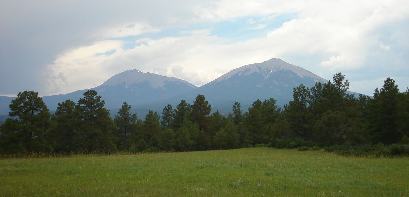
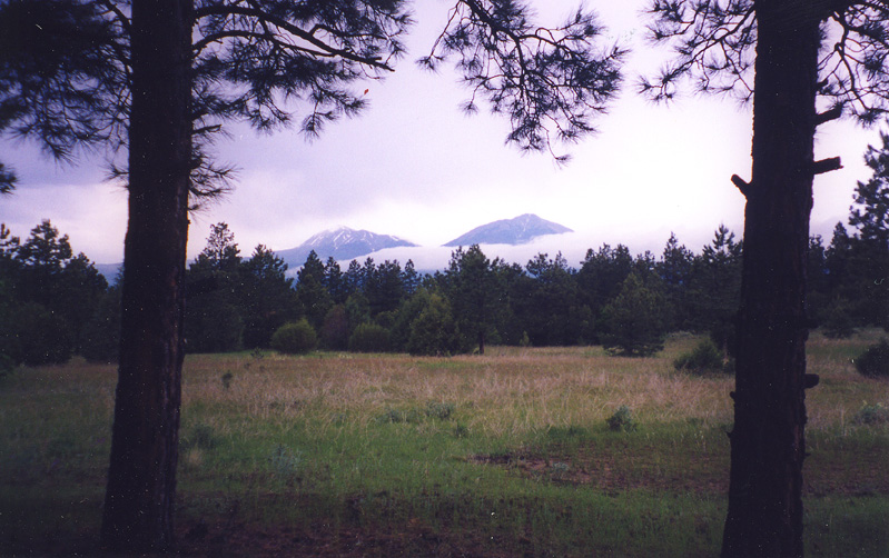
Below, Spanish Peaks from one of my high meadows.

The Ute and Comanche Indians called these two mountains "Wahatoya",
roughly interpreted as "breasts of the earth".


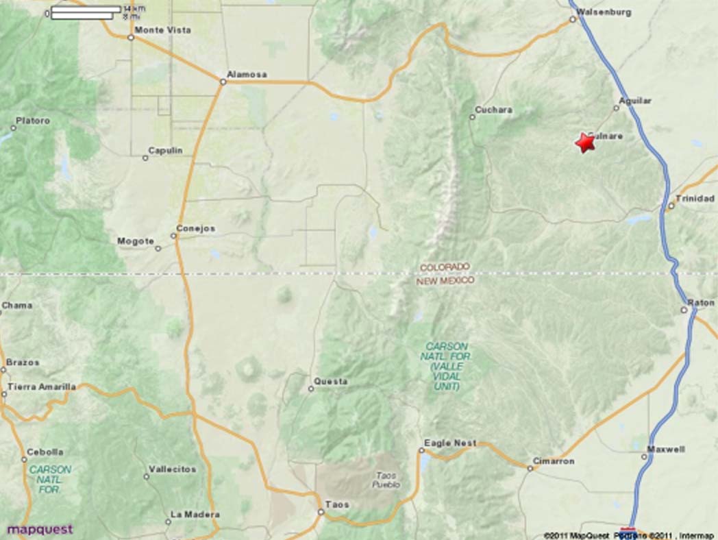
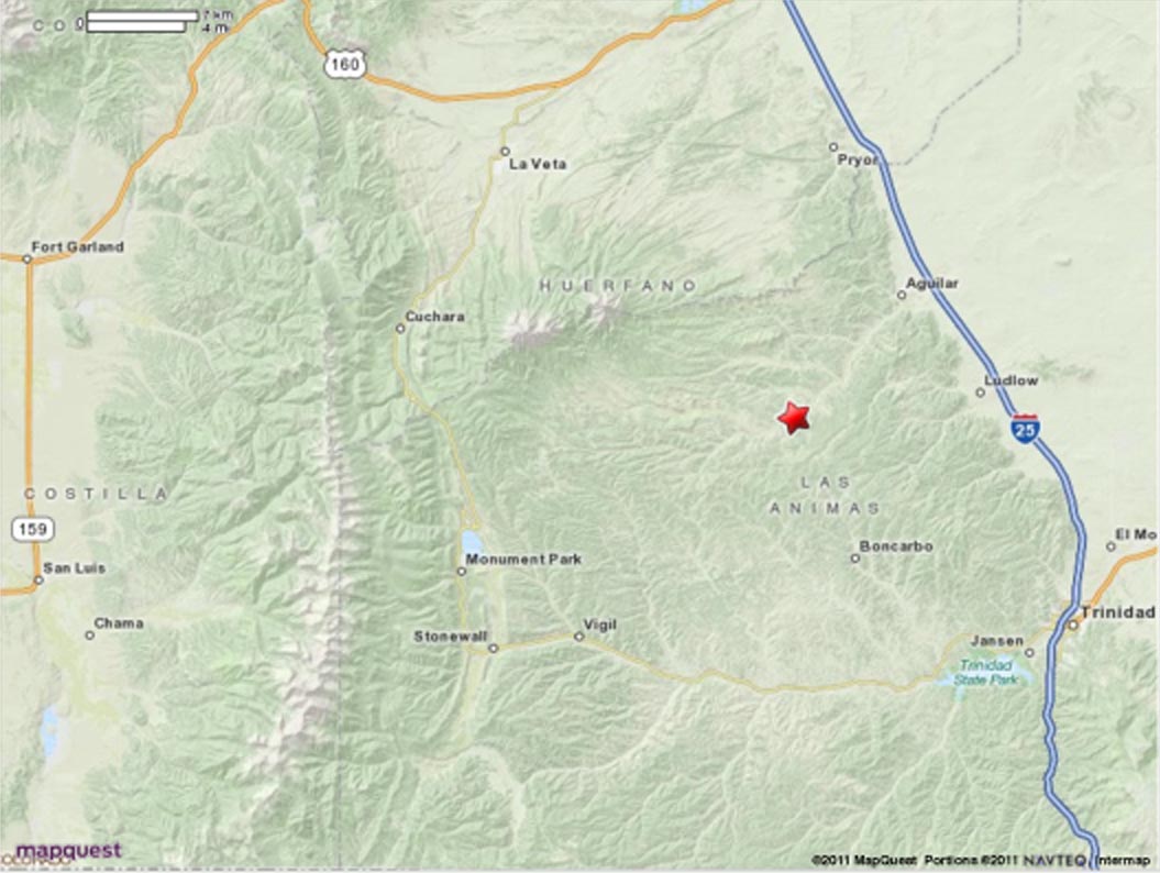
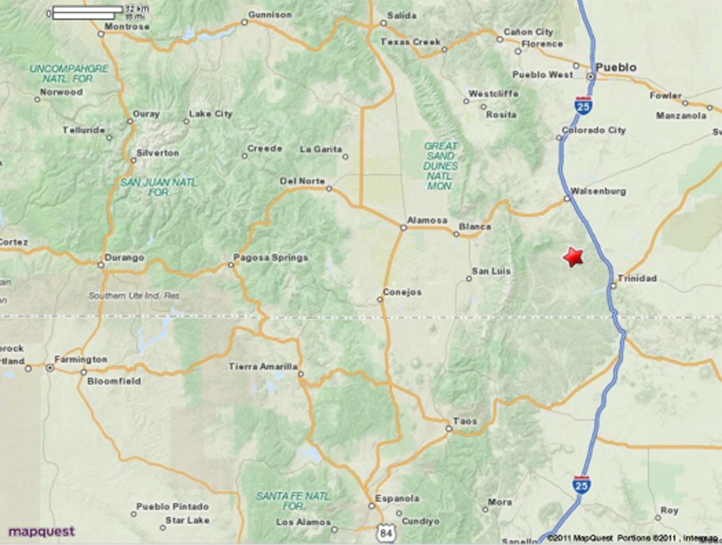
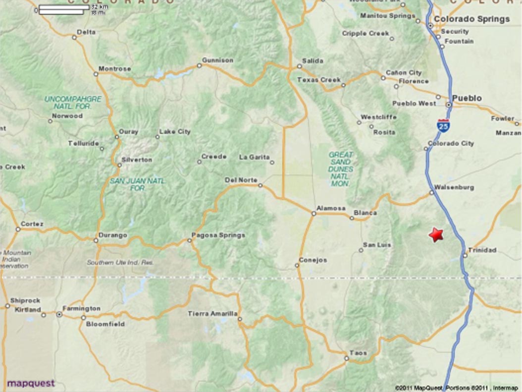
This ranch is located within western Las Animas county Colorado, which is just north of Raton,
New Mexico. This ranch is between the Spanish Peaks and IS-25. The Sangre de Cristos are just
west of the Spanish Peaks. Elevation of this ranch is roughly 7,100', with year around access.
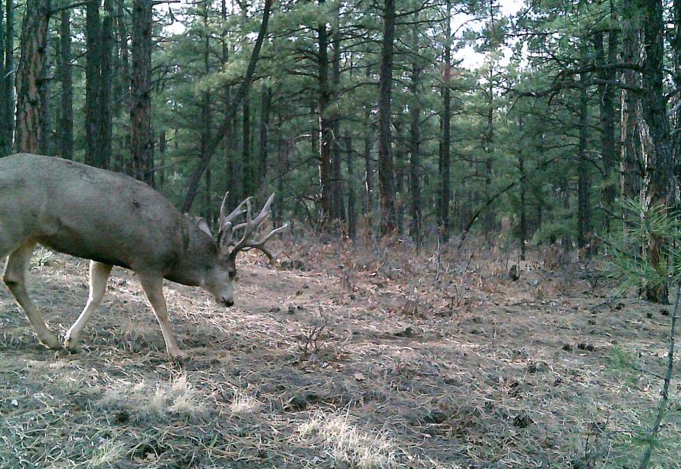
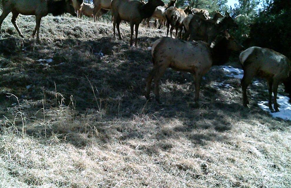
One of the largest herds of elk in the entire state of Colorado is located within this county
and the adjacent counties along the Sangre de Cristos & Spanish Peaks area (San Isabel National Forest).
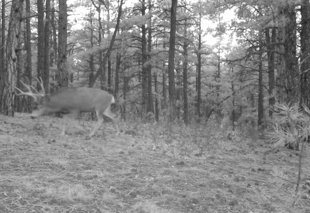
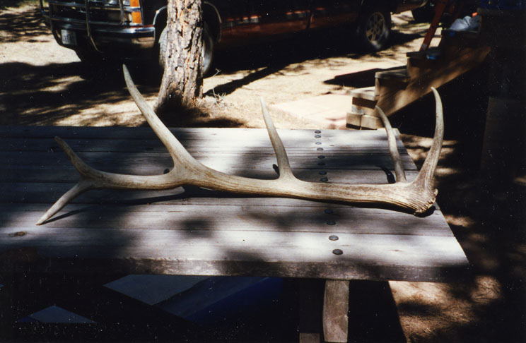
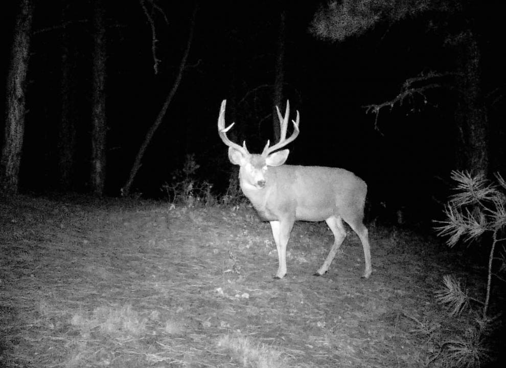
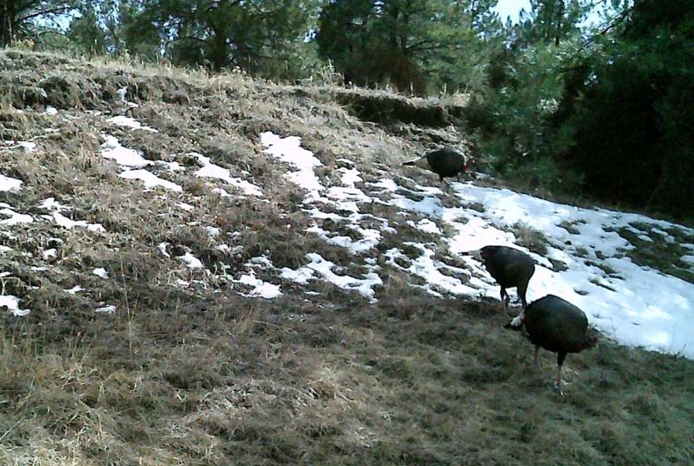
This is prime wildlife habitat with elk, deer, bear, turkey & tufted eared squirrels residing
on this property most of the year. It could be used for either a homestead, recreational activities
or for hunting, as you choose.

Great Prepper or Retirement Property (low population & low taxes)!

County Taxes on the entire 264+ acres is less than $150/year.

This land is located with the southeastern corner of "Apishapa River Ranch" development, which is
the Nicest/Prettiest of it's type within the entire Las Animas county. The southeastern corner
of my land borders County Road 44.0 (Ludlow raad), which could be used in the future for
quicker access.

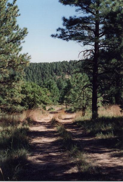
Recent paving work by Las Animas county on CR 44.0 has brought a paved road to within
3/4s a mile from my western gates on Bear Claw Pass
.

I've installed about 2/3rd a mile of electric lines going from the western gates up to the
high meadow in the southeastern quadrant, where my cabin is. There is a pole with a transformer
within about 100' of the cabin and service pole within about 30' of the cabin, for a meter.
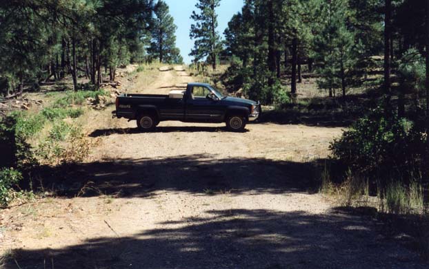
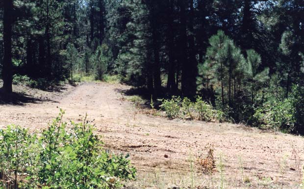
I've also had about 2/3rds a mile of a good road installed from the western entrance up to the
High Meadow near which my cabin resides.
_____________________________________________________

All this land has been Professionally Surveyed and conspicuously marked at all major
corners with a 10' 2" PVC pipe slipped over a T-Post & a steel stake in the ground
by one very competent surveyor, yielding a uniform/homogenous/consistent/integrated result.
The PVC pipe is just there to draw one's attention to the steel stake Property marker.
Minor corners may only have a steel rod driven in the ground. We have a large survey
map of all my property (3'x4'). A full survey map of all my land will be provided
to the actual Buyer of the full 264+ acres along with the deed.
__________________________________________________________________

**********************************
__________________________________________________________________

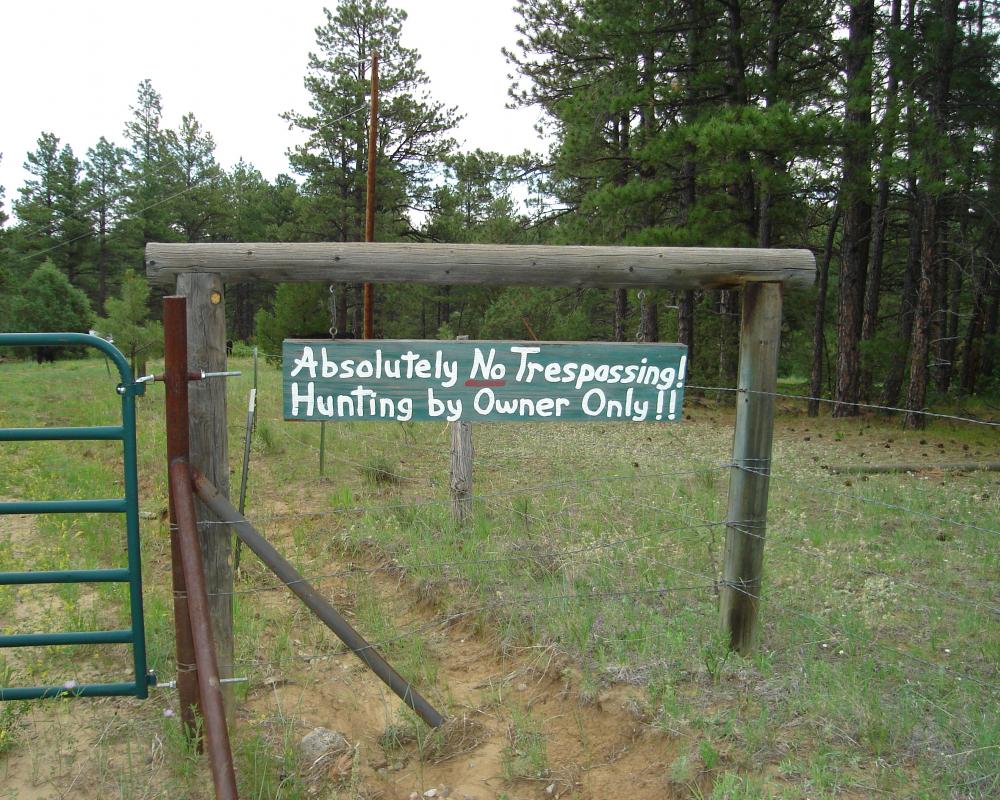
NOTE: we are just private land owners, Not 'developers' or realtors/shysters, NONE of which
will we Deal with under any circumstances. NO Exceptions. Principles ONLY
! Period!
Anyone that ignores that is simply wasting their/our time
.
__________________________________________________________________

**********************************
__________________________________________________________________

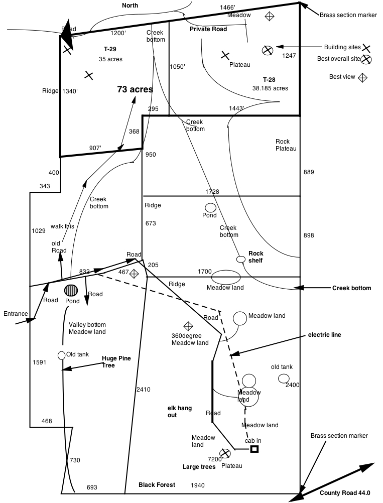
When the JV developed this land back around 1990, they only provided to each tract a primitive
road to the boundary (one single point) & electricity to the boundary (normally the same point).
We've considerable improved on that very basic state: much better roads & more electricity.
On Tract 28 (northeast), we installed a long road from near the northwest corner up onto the
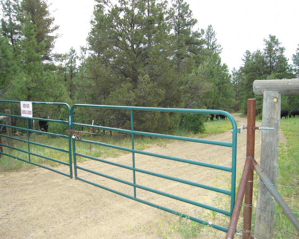
ridge, where most of the tract lays, providing very good accesss at our expense. We also
installed locked double gates on that new road to give this tract very good Privacy.

Excellent place on which to live, raise your own food, harvest your own energy and SURVIVE.

As Jim Sinclair coined years ago, "GOTS". "Get Out of the System" and that door has already
started closing. Time is getting short before The "Powers that Be" (Luciferian/Khazarian Illuminati)
crash it all down. We hope that you're getting prepared/ready.

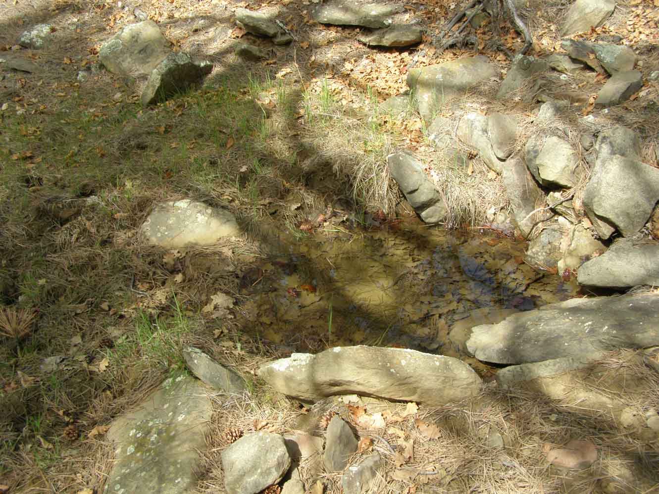
A well, tall windmill & a large cistern could allow you to exist off the grid with the essentials.
There is a dowsed well site very close to the prime building spot at near 7200' elevation (hill top).
There is a 2nd dowsed well site on the 360 degree view meadow, north about a quarter mile (hill top),
which could be used for watering livestock/wildlife away from the house.

Due to all the rigging/manipulation of the Entire Fraudulent US Monetary/Financial Systems, the days
that we will still accept Federal Reserve Debt notes (US-Dollars) for this land are getting fewer. Expect
that day (as of yet unknown) to be very soon, possibly 2024 (1st/2nd quarter).
.

After which, payment must be in "certified" gold/silver of acceptable denominations/types (to seller)
: US Gold/Silver Eagles & well known credible (US & Canadian) Silver (Kilo/100oz) bars as in RCM or RMC
(NOT Crooked COMEX, LBMA, Scottsdale or Perth Mints!) The proverbial Financial "shit" is about to HIT
the Fan (2023). More on this below ...

Repeat: the last day that we will accept Federal Reserve 'Debt Notes' as payment will be around
when the prices of Precous Metals breaks out, expect by early in 2024
. We will not sign
any contracts where payment is delayed.
We do not know when the fireworks will go off, but we expect it to start in early 2024.

Expecting a Global Financial systems crisis around early 2024: possibly FED debt
implosion driven, FED raising interest rates, completely engineered, as usual or China's real
estate debt (Evergrande) implosion. If you have NOT noticed, the "old" world order (Globally) is
breaking down, rapidly, and it will only accelerate from here/now, i.e. during this global "war"
against all of Humanity, evidenced by the Communist Traitorous Lunacy coming out of the "Luciferian"
Washington D.C. these days (Obama/Biden/Bushes/Clintons-Rockefellers).

Evergrande Declares Chapter 11, BANKRUPT (Aug 2023)!
Another even larger Chinese bank is right on it's heels,
Zhongrong, which controls TRILLION of dollars in asset, has begun defaulting on payments
August 2023, meaning they are on the way to going Belly UP
!
This can be the match that takes down the completely Fraudulent/Criminal US Financial System.

This is going to start coming to a head in 2024. Get READY for MEGA Change on
many Fronts.

Note: if the currency is crashing faster than the markets, then they can crash up, meaning that
the measuring currency has become worth so much less in value faster than the market is going down.
While the "real" value goes down, the "declining" measuring tool makes it appear that it's going up.

Evergrande (largest Real Estate Co. in China) has DEFAULTED (Dec-2021)! Huge Reprocussions world Wide!
Evergrande is tightly linked to much within the Chinese/Global economy & it's massive global investments.
This is NOT an accident. This is planned Warfare, "Economic Demolition" on their Adversaries, with INTENT!

"China has spent years creatively hiding debt, but now cracks in Chinese markets are growing, starting
with China's Evergrande real estate crisis."

"Originally brought to light by the then-Fitch analyst, Charlene Chu, China had long been hiding vast
quantities of debt that it had accrued through a multitude of state-related businesses through a range of
difficult-to-examine schemes, most notably back then "wealth management products" (WMPs)," writes Simon
Watkins of OilPrice.com. "...In practical terms, they were an amalgam of layers and layers of liabilities built
upon the same underlying assets, much as was seen with subprime asset-backed securities that the Western
banks had in 2007/08 in the lead up to the onset of the (that) Great Financial Crisis."

This Financial Collapse that has been engineered over the past 53 years will bring down the entire
Global Financial & Fiat Monetary Systems, as it has been intentionally designed to do this since the
early 1970s, when they created "derivatives". Afterwhich, Bill "Rockefeller" Clinton dismantled the
Glass-Steagall Act, a necessary move to ROB the American People, of ever single dollar within either
Banks, Stocks/Bonds or Retirement funds, completely when they pull this last Plug in this Rigged and
Fraudulent "global financial" dike.


The Chinese Communist Party (CCP) & Luciferian-Illuminati Bill Gates are now the two largest owners of
American Farm Land, and both are Criminals.
See "Holodomor" below .... and start thinking.

"Survival" may come to equate to being 100% self sufficient pretty damn soon. The Wise, Get Prepared.

Food prices expected to rise sharply in 2022-2023, but food shortages are expected in mid-2023/forward.
Think "Greenhouse" and "if done right", they work in colder climates, even well north of Colorado,
without the exorbitant cost of fossil fuel energy. A wood stove as backup would be prudent, as
cost of this fuel is free, growing on this land. Engineered "Holodomor", look it up. It was used by
J.Stalin against the Ukraine (1930s) and by the British against Ireland (mid/late 1840s/50s) & India.
And it will/is being used against America with increasing intensity over time, hence higher prices,
and then (eventually) just "unobtainable".


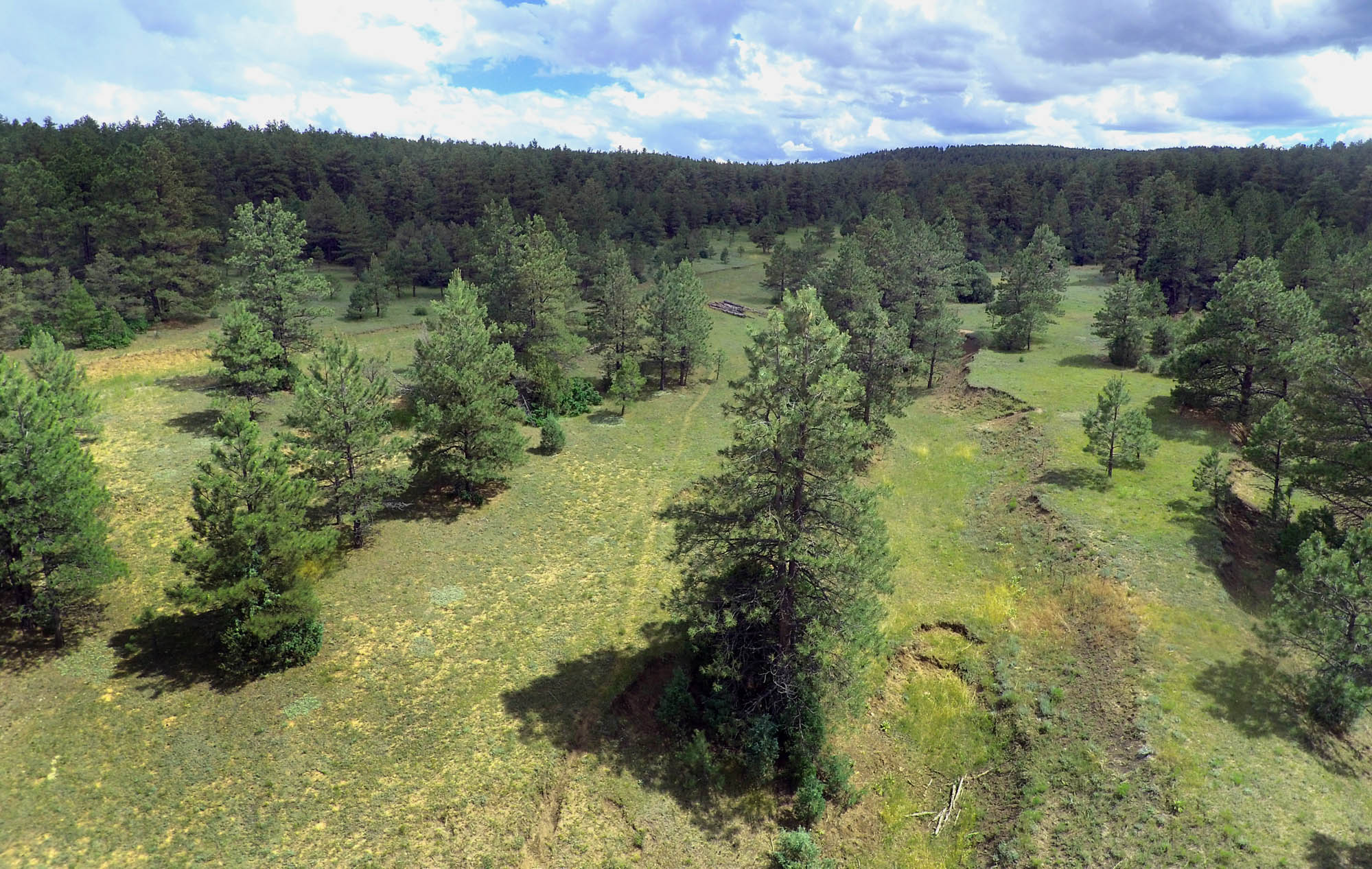
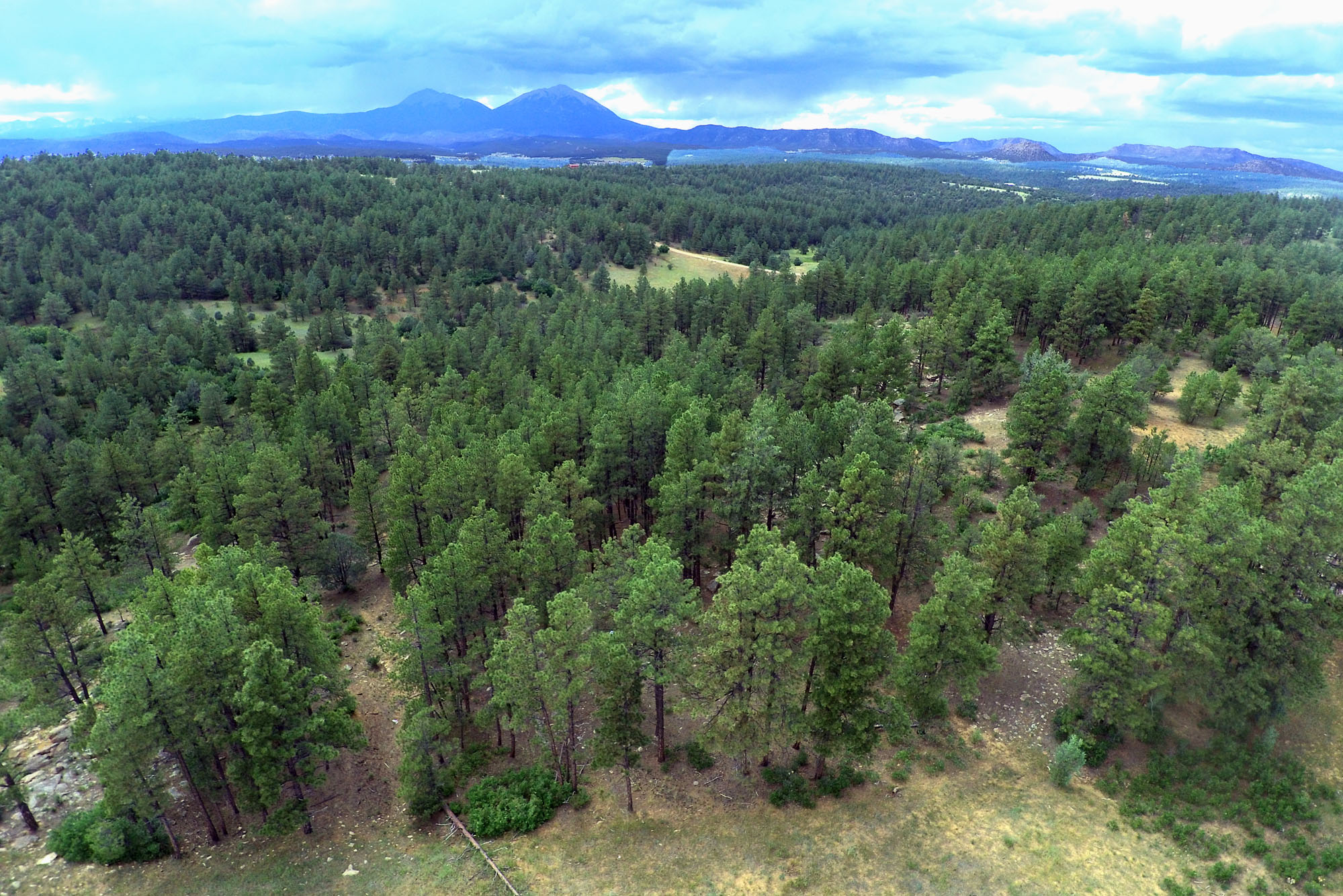
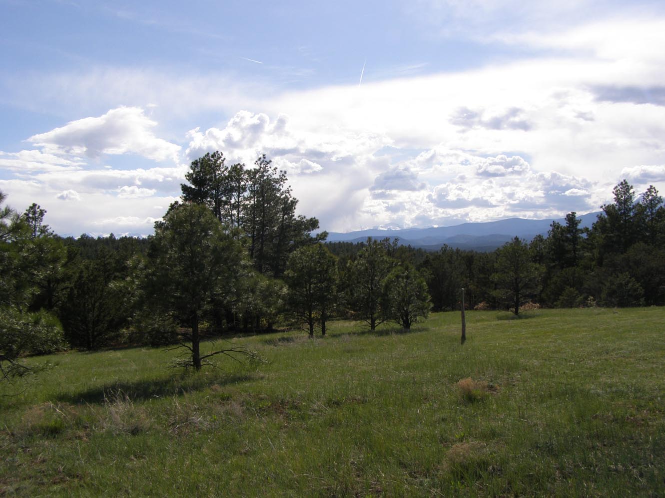
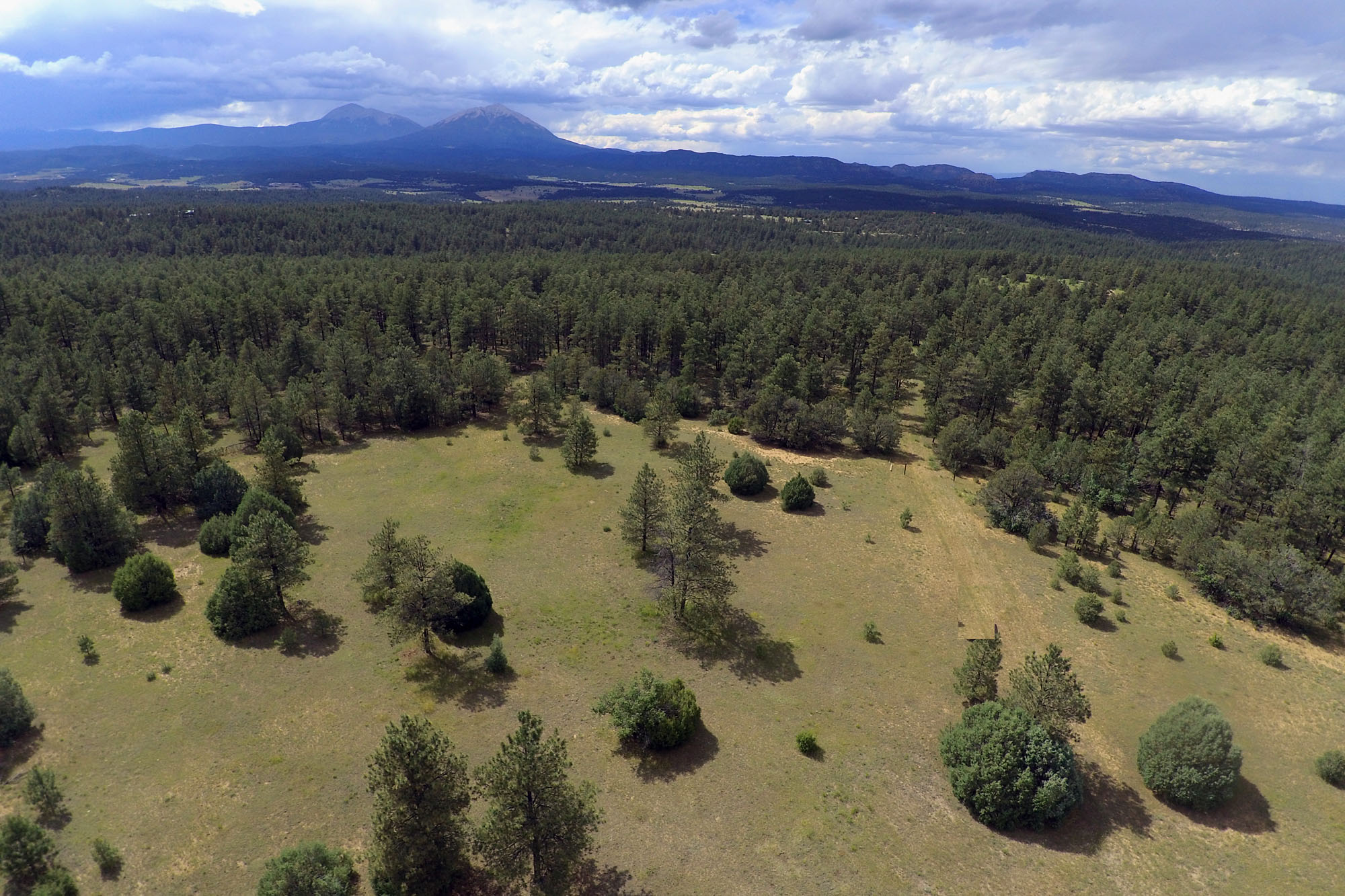
Picture below was taken from above the meadow in the southeastern quadrant, near the highest elevaation
looking northwesterly.


Highest elevation is just over 7,200 feet above sea level (bottom of southeast quadrant, bottom right) & is the best building spot.


The descriptive term "Red October" has been presciently applied to right "now", by C.High.

"Everything is in the process of breaking down: Food production, trucking, health services,
millions will get very sick and many of them will die, the military breaks down, political
system breaks down and the financial system will suffer a horrible unfixable crash."
"The breakdowns will wake up the masses to all the evil that has been hidden (for way
way more than 2 centuries here in America)." For the masses that have been asleep, "There are
so many layers it's going to take a long time for people to come to some understanding,"
and the process of coming to that(some) understanding may take them many years to unwind the
entire system of lies/deceptions in which they have lived their entire lives.

It's taken me over 15 years of intense research to get a grasp of the Criminal infiltration/
subversion that's taken place in America & globally, by a highly organized, ultra wealthy
Luciferian Khazarian Mafia (the International Illuminati, comprised of many sub-organizations),
which dates back to Nimrod & Babylon, under the Satanic influence of Satan/Baal.
Evil is Destructive, including self destructive (in process). None of this Chaos/Decline is an
accident. It's ALL been meticulously engineered by the Satanic Illuminati.

General M.Flynn Exposes Deep State Plan to either Trigger Civil War &/or Collapse the Global Financial systems

General Flynn's Prediction Comes True: Globalists Triggering Worldwide Financial Collapse to Launch Their Agenda

If there is NO currency, there can be NO viable economic activity, which requires a method of payment.
Which is how the Criminal FED engineered the Great Depression, as it withdrew at least 1/3 of the money supply
from circulation. No currency means NO economic activity occurs, all done by Design.
While the Criminal FED is pouring Trillions into the Major banks to keep them from Collapse, expect
them to employ the same technique that they used to Engineer the Gread Depression again soon,
against the American People to collapse the country so they can try to take TOTAL Control.
The hard/cash money supply in circulation, particularly with cash/coins, is already shrinking.
When the FED crashes & it will (cause will be international banking, outside the US), all the Banks
will be D.A. Broke & shut their doors (coming). All funds within those banks will be GONE for good,
as that is their original long term plan.

The real US National Debt is NOT around 30 Trillion, as they keep saying. It's really around
150 Trillion bucks. At least 94 Trillion is missing from the Pentagon alone, presumed "STOLEN".
This is NOT considering the tens/hundreds of TRILLIONS in "Unfunded Liabilities", which is another
story. This is the soil from which "hyper-inflation" springs, grows & endures, which is intentionally
being created by the Khazarian Mafia NWOrder, president Biden (really Barry Soetoro, aka: Obama, NOT).

Real Inflation rates for 2005-2019 ran between 9% & 10% per year. 2021 was at 15% and by early
2022, we were running at 17%, increasing by end of 2022. All per John Williams at shadowstats.com.
It could explode by mid September of 2023. This an intentional war on us by the New World Order.
Think "9/11" version two, which should hit in September of 2023.

While Dr. Skidmore was revealing all the TENS of Trillions of US Dollars that have been
STOLEN from the American People by their own CROOKED government. Trump & Congress
passed the FASB 56 Legislation (under the cover of the Kavanaugh hearings) which made the
Entire "US financial books" a matter of National Security, which NO ONE can Now SEE.
Which allows them to both ROB us and then HIDE all the Evidence.

America may survive, but NOT before going through the FIRE (Phoenix) and only THEN will she
begin to rise out of the Ashes of the destruction of her perverted/distorted/Luciferian-criminal systems,
beginning in 2023.
While the country may survive, that does NOT equate that ALL Americans will, as they surely will NOT.
Are you ready? Being "way out"/away from any/all Urban centers would be most prudent/wise.

We have near 220+ years of Luciferian infiltration/subversion to clean up & to rebuild our
intentionally destroyed political-systems/economy/financial-systems/manufacturing/infrastructure,
which will take us many many years if not decades. But first this infiltrated/corrupt criminal
Enterprise must FALL, and Fall it will, beginning in early Fall of 2023, and the Financial markets
towards year's end at the latest.

Beginning with Rockefeller tied Carter, the US Luciferian Presidents/families: Bushes, Clintons & Obama
are ALL working together behind the scenes to Take America Down! G.H.W.Bush selected/inserted
Bill "Rockefeller" Clinton into the White House & continued instructing CIA-Barry.Obama on what to do
during his subversive/criminal presidency.
The Bushes, Clintons, Obama & the Luciferian New World Order are all running the Phony/Criminal Biden/Harris Sham.

We're NOT in Kansas any more Dorthy .... WUP if you can ...

It's more like Cambodian "Genocide" under the Marxist "Khmer Rouge" & Pol Pot, that was
placed into Power by the NWOrder created/run Criminal CIA (Criminals in Action).

"stagflationary (US) collapse" coming SOON! -- Brandom Smith

_____________________________________________________

Asset prices of real value are going up all over the country and the REAL reason for that is
is that the value of the "backed by nothing" FIAT currency, the Federal Reserve "Debt Notes",
are loosing value at an accelerated rate (17.5+% now). The life span of this dying currency is
NOT years, but could be literally months at best. When it goes, it will be just like the WTC
towers falling, i.e. near that QUICK, which is why we will sign NO contract that has any delays
whatsoever. If any buyer is not ready to close quickly, then come back when you are.
But don't be surprised if the price is NOT higher then, as It will be raised near monthy,
if not sooner, due to the crashing value of these near 'worthless' "DEBT Notes" by a Private
Foreign Bank, the NONE "Federal" NO "Reserve" Bank. If you don't know this, the same folks
that created/own/run this Foreign Bank (Khazarian Mafia) are the exact same folks that are
trying to kill us all with their engineered BioWeapons (both Covid-Coronavirus & deadly
NONE vaccines, which contain Graphene Oxide & the same Spike Protein that they attached
to the Coronavirus & much more). And as a casualty of this War, this Criminal Bank will
be Taken Down, which will have huge repercussions for America. WUP if you can. The World
has completely changed and it will NEVER go back to what it was Pre-Bioweapons, which is
pretty much what ALL "World Wars" have done in the past & We are in a World WAR right now!

_____________________________________________________


All lands for sale by the most local realty office in the Apishapa River Valley or nearby have
been sold out recently, as of late July, 2020. They normally have about 30-35+ listings, on
average. Meaning supply of land like this is getting quite scarce. This is the beginning of
long term trend as folks flee the cities & Towns in effort to survive these military grade
bioweapons & the communist take down of America, collapsing the entire US/Global Financial
systems, by design.
To the best of my knowledge, this local realty office changed their name & relocated their
operation/focus to La Veta in Huerfano county (north).

I think everyone knows what scarcity does to prices, so don't delay too long, as scarcity
& prices increase, due to higher demand & dwindling supply. 35 acre development ended
in this area well over a decade ago (due to the engineered financial crisis of 2007-8).


Prices are FIRM, not "asking prices". Cash deal to seller only.
(See more extensive/detailed Terms for buying below ... don't miss them if serious.)

We don't accept/respond-to counter "offers". Each tract or grouping of land is based
on it's unique characteristics and has it's own unique valuation. There is Always
cheaper land & it's usually cheaper for a reason. If that's what you want, good luck
with it. We don't have any of that & hence, we have NONE to sell.

This property was previously listed with the largest Rural Land Broker which
operates in Colorado (and around 7-8 other states) and they researched/validated my pricing.
Easy to test. Just find another piece of "developed" land this size (similar characteristics)
within Colorado this nice at a lower price. You will NOT.

BTW: real current US Inflation rate is running at 17-18% in late-2022 and was running at 9-10%
inflation rate in each preceding year beginning about 2005, via John Williams of
shadowstats.com, who calulates all the government statistics using the Pre-Clinton
perversions where Clinton wanted to declare a surplus when there was NONE, so he just
rigged all the accounting formulas to fabricated a result that was NOT real. And it's
never been fixed by any president since, as they didn't have the courage/integrity to
deal with the consequences of that much Honesty. When this much higher real inflation is
factored into the GDP, it means that we've been running a Negative GDP for at least 16
years of around -4/5%. Translation, if you run -5% GDP for 20 years, you've basically
killed your economy. And that is pretty much what they've "intentionally" done. BTW: 17.5%
of the current price is nearing $250K/year increase. Waiting will only increase the cost of ALL
assets that have "real value", which is what will/can keep us alive during these
subversive/challenging times, which will last many many years.
I'd expect the REAL value of inflation in 2023 to be at least 15% but possibly approaching
20% (if not more), by design.
Price increases at least quarterly, if not near monthly, should be expected with this
high level of inflation
, which is a way of saying that the currency (FED "debt" notes)
are becoming more "worthless" monthly and that it is, as it's a complete Fraud.
All Frauds end quickly.


Visiting the property is possible. I'll give you the necessary information/directions,
and permission to come upon my land for "a viewing". This is NOT an opened "permission".
My property is posted "NO Trespassing" for a reason. I do NOT allow free access to just
anyone when ever they please. All of the Apishapa River Ranch is 100% "PRIVATE Property"
and access is by "Permission ONLY". Violators will be dealt with.

Prices as of late Feb, 2024. They could change again soon by mid-year, as the entire Financial System collapses.

The 2020 Elections were STOLEN! -- Now proven.
See also: https://2000mules.com/

Fraud vitiates everything! By the middle of 2023, this will be PROVEN and Trump may be
reinstated as President, as he really won the 2020 Election. Many in Congress will be removed
and Conservatives Christians will have the Majority and an Ethical Government will be the
consequences, going forward towards the 2024 elections, the winner of which will be a
Righteous President, unlike any that we have had since Calvin Coolidge, who assumed the
Presidency in 1923. After which, America has had near 100 years of New World Order Criminals
in the White House.

18-month, data-driven probe concludes, proving that the 2020 elections were stolen;
Smartphone pings, videos reveal at least "4.8 million fraudulent votes".
CIA-Obama, the real acting president, fronted by Dementia Pedo Joe will NOT
finish out their Stolen Term.

Prices/Payment-Options (Precious Metals) may change again in any month of 2024,
to reflect the new Reality of the Changing Global Economic ReConstitution & US decline.
Being: DeCentralized with "NO Central Banks", which means "NO FIAT Currencies",
which is coming way sooner than you may think (in process by year's end).
Wake UP if you can.

Being sold ALL together.
We are not breaking this up & selling this in 5 individual tracts
.

Current PRICE (temporarily reduced):


                                 1) 264.4 acres for $1,400,000       Developed land, 5 contiguous tracts ranging
                                  from 35-100 acres each, 3/4s mile tall by 1/2 mile wide, of very Private land.
                                  All but the 2 northern tracts (originally 7 tracts), (#28 & #29, were sold in 2022).
                                 

Less than $5,300 acre.
                                 

"Terms of Sale" are below.


Since we currently live in Texas, I'm going to mention that this Land is NOT $15K-25K/acre,
like now in Texas! Nor have we raised the price due to these BioWeapons, but will soon due to
actions of the Luciferian-Illuminati (Khazarian-Mafia) created/owned/run NONE "Federal Reserve"
FOREIGN/Privately-Owned CENTRAL BANK, which is what the FED really is, as they crash the Global
Financial systems in their efforts to gain Total Control of this entire Planet (eminent).
Jumps in price on the order of 50-100% could be the result as they utterly destroy the Global Fiat
currency systems, while telling us all how fine everything is, as they covertly engineer our demise.
The FED's induced intentional "inflation" via their ingrained Graft is driving ALL Asset prices higher.
Time is NOT on our side, as really "hard times" have been engineered for us, over a period of decades.

When they take the US Dollar down in 2024, it will loose 1/3 of it's value in just one
day & hence prices could/will jump up by 1/3 in just a day.
We are approaching that moment in time now. 2024 will be the year of a financial reset,
which has been planned and set in motion 50 years ago, when they created derivatives,
the purpose of which was one, to control the price of ALL assets & two, to eventually
crash the Financial Systems of the entire planet (Coming). It's the reason that all
the major banks have been accumulationg gold for the past decade, on the quiet/covertly.
We are going back to a Gold Standard, which is why the Russian Ruble is now Gold backed
as in the Chinese Yuan, in the sense that you can buy gold at the Shanghai Gold Exchange
with the Yuan, which Russia has been doing for years when China pays Russia with Yuan
for the engergy products (oil/natural-gas) that it purchases from Russia. This is the
same thing that Saudi Arabia has been doing for years when it sells it's oil to China
for Yuan or Russia for Rubles, all of which are Nails in the US Petro dollar's coffin.

If you snooze, you'll could loose the chance of owning this Jewel at this price!


Picture below is mostly just of my land, except that road (Elk Trail) on the north, which is just above my property.


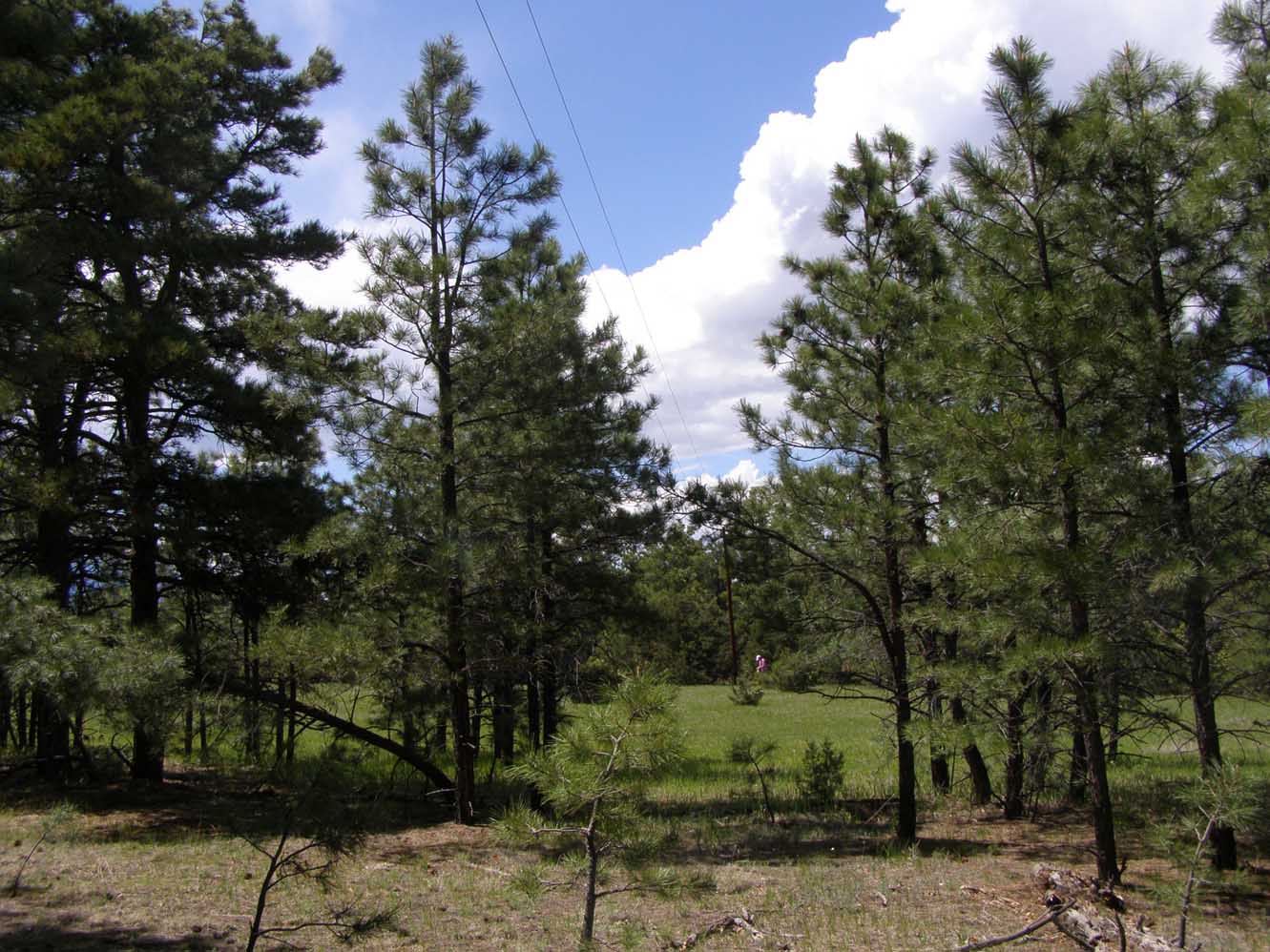
This picture is taken across the same meadow, which the aerial picture above was taken of.
Highest elevation is just over 7,200 feet above sea level (1.36+ miles high) & is the best building spot,
which is just behind these 2 trees in front and to the left/south of where this picture (below) was snapped.

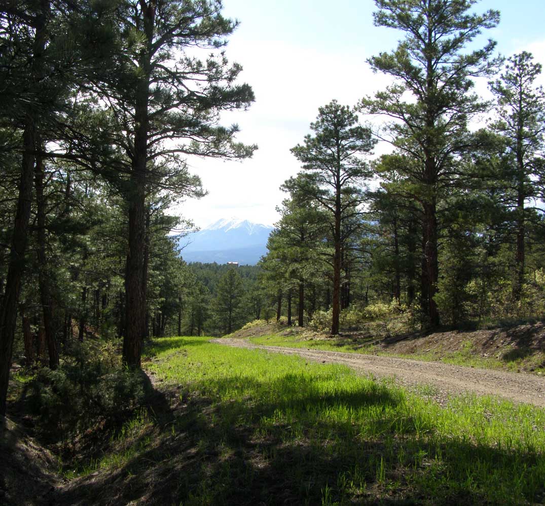
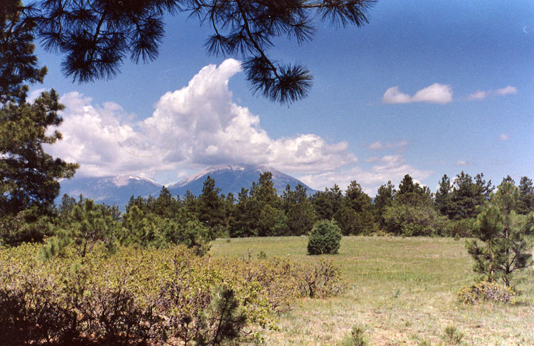
This is my favorite building site, just within the trees, on the east side of this meadow, with great views of the Spanish Peaks.
The Sangre de Cristos are just west of the Spanish Peaks. Late fall picture. Taken on 100ac tract.

Terms

Prices are subject to change over time as the U.S. Dollar looses more value
and these prices are not encumbered with any commissions. We are not Realtors
or developers and we are NOT paying for services that we do NOT need. We have
owned this land for 31 years & are just letting the next generation have their
turn at enjoying this wonderful property. We are willing to sell this property
to any buyer on a straight Seller to Buyer deal, with NO bureaucratic middle men
of any kind.
If you are not capable of doing that, then just keep looking ...
This is exactly the way that we bought this property 30+ years ago, and this is
exactly how we are going to sell it this time.

Terms are a straight Cash deal to the Seller. We are NOT a bank.

That is what we will do & here is what we will NOT do: deal with any realtor (period!),
sign or use any CO state RE contracts, Period
,
as either of these by their nature gives the CO State the Dominate role in any deal, but
where they have NO ownership & NOTHING invested. We are NOT residents of Colorado, and
am NOT under the control of this state. This is exactly the way that we bought this property
30+ years ago. If that works for you, please contact us if interested.

Seller will NOT agree to an "offer to buy" based on ANY extended/delayed closing date,
including waiting for some Bank loan (taking weeks) or for any other reason.

______________________________________________________________

**************************************************

Anyone OBLIVIOUS enough to ignore those 2 paragraphs, just needs to keep looking
for their property, as anyone that inflicts a dumb/incompetent/statist realtor on us
will be quickly/completely IGNORED! Don't waste your/our time
!

**************************************************
______________________________________________________________

We will acquire/deliver a Title Abstract of the property (only if required), but we will
deliver a Warranty Deed to the buyer so that they can personally have it recorded at the
county seat. If it gets lost in the mail (going in either direction), we'll provide another one.

Seller is expecting a closing date of just a couple of weeks, enough time to get a contract
worked out, signed, payment made, and a Warrantee Deed delivered. Straight forward/simple.

_____________________________________________________
Chain of Title for my land for the past 60 years or so is:

- We have owned this land for the past 33 years give or take "1" year (acquired 1990-1992).
- Before that, a Joint Venture acquired this as raw land (1988) and developed it and
sold it off in tracts, mostly around 35-40 acres with a few nearing or at 100 acres.
All land within the "Apishapa River Ranch" were initially sold by early 1993.
- Prior to that, an investment company bought this land as an "estate" cattle
ranch and then sold it to the Joint Venture relatively soon thereafter (1988).
- Before that, it was owned/ranched by "Pete Cusimano" for perhaps 25-30 years or so,
late 1950s or early 1960s through mid 1980s.
_____________________________________________________
All this land has been Professionally Surveyed and conspicuously marked at all major
corners with a 10' 2" PVC pipe slipped over a T-Post & a steel stake in the ground.
Minor corners may only have a steel rod driven in the ground. We have a large survey
map of all my property (3'x4').
_____________________________________________________

Call for the current prices, as the prices will vary due to the failing value of either, the
U.S.Dollar, as indicated by either: the rise in the value of Gold/silver compared to the declining
fiat U.S.Debt-Dollar, which has already lost a significant % in 2020, or the inability to acquire
precious metals due to their massive price rigging via naked shorts &/or derivatives. The
Official US Dollar Index & the precious metals markets are already way too Rigged to be dependable,
via the phony Biden Crime Syndicate, FED/Wall Street banks, not unlike what has been going
on now for the past five+ Decades ... just a bit worse now & much more obvious.

Expect prices to change at least weekly at those times when the US Dollar destruction
r r is underway &/or accelerating, expected now, as soon as 2024.

Silver is already near unobtainable in any large quantity. Gold is beginning to follow suit.

264+ acres qualifies one to apply for one private-land buck tags per year.

Sale is for the surface rights only, as the Seller does not own any mineral rights.

There are a set of Restrictive Covenants(RCs), which were created to help each owner
protect their own rights & that of their investment, however there is NO official
Home Owners Association. Hence, there are NO legally required dues or fees.
Enforcement of the RCs is by each owner only and any owner can enforce them should
the situation arise. (We did not originate these RCs. The developer did in 1988.)
FYI: Over the past 31 years, this has never been needed/done, to the best of my knowledge.
[Mobilhomes are not allowed & travel trailers are only allowed under temporary conditions.
Dirtbike (motorcycles) are strictly NOT allowed, as Colorado is a very delicate environment
and dirt bikes are very damaging & this environment does not heal within decades.]
FYI: an ad hoc group is leasing out this property to keep the taxes low based on
agricultural use. Anyone can fence off their property entirely or in part (house).
My land is fenced on the East & South sides and has about one thousand foot of
fence on the western side, just north/south of where Bear Claw Pass enters Tract 22.
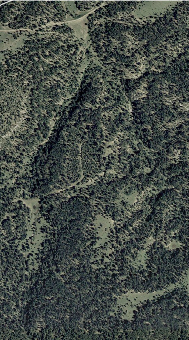
See map below: Bear Claw Pass is where it has "Entrance" on the left side and T-22
is the 57.8 acre tract on the lower left part of the detailed layout map(below).

For those of you that do not know that they put in a bunch of natural gas
wells all along the front range of the Rockies from New Mexico to Montana,
from about 1994-2008. They only expected them to last about 15+ years and the
production was not as good as they hoped. 2008 + 15 = 2023.
Once they put in a lot of wells about 2005-2007 or so, they over supplied the
market and the price per unit dropped from about $10 to about $3. It's less now,
(below $2.00) so while they are making some money (perhaps), they are running skeleton crews
and ownership has changed. Update: due to engineered Oil shortage by the NWOrder,
May 2022, NGas went up to near $7-$8/unit, which I would expect to continue occasionally.
until the NWOrder control of the US is diminished, & oil is once again allowed to be produced,
and/or traded Freely, instead of the price being rigged with derivatives.
Still quite a bit below $10/unit.

There are 6 Ngas wells in this section and 2 wells on my 264+ acres.
The well in the center of my property has an electric motor, which they all could have
if you pressed them to do that, as there is electricity close by. They will not do this
unless pressed.

Their rights to extract the NGas does NOT override your Right to the Quite/Peaceful
enjoyment of your property.

I'm expecting them to completely shutdown in a few years, but in the mean time,
they help to maintain the roads at their expense, which they signficantly improved when
these wells were first put in.

PNR put in these wells in 2007-8 and now Evergreen owns/operates them. We had PNR agree
to electrify the 2 wells on my place including T-28 that were not already with electric
motors (quiet), but I had a wreck and could not get up to CO to work out a route to put
in the electric lines, so it didn't happen. That was in 2013. I didn't want to just let
the Electric Company to just put them where they wanted (as they don't care what the land
looks like afterwards, but I do). I personally cut all the trees on the line I ran up near my
cabin (southeast), back in 1993 over the Thanksgiving weekend, 2/3rd a mile in three days.


Electric line as it crosses the "rabbit foot" meadow going to my cabin, which is within 100
yards of this meadow.

Hope ALL that information is helpful.


All parcels have both electricity and all weather roads to them, except tracts 26/27 (not forsale alone).
The electric line is within about 150-200 feet of tract 26's southwest corner & boundary.

Cell phone service works in the area, except down in low/narrow valleys.

Currently 264+ acres of this land is available. Web Site will be kept up to date.


Below is the west branch of the Castro Valley, near my western boundary in the southwest
quadrant, looking southeast, aerial view.


[ The area around the Sangre de Cristos (southern extension of the Rocky Mountains) & Cuchara
in the San Isabel National Forest (not labeled on the map.) ]


More details below, toward the bottom of this page, including maps, topos and pictures.


This ranch is located in southern Colorado just north of the New Mexican border and east of the Sangre de Cristo mountains (a southern extension of the Rocky Mountains). The two mountain peaks you see in the picture above are the Spanish Peak, which are two ancient magma plugs. This land is roughly 70% covered with Ponderosa pine. The rest is a mixture of meadows, lush canyon bottoms usually with water moving through (see picture below), large rock formations and some Chinook.

The wildlife is plentiful in this area of Colorado with Elk, black bear, mule deer, large Russian turkey, tufted eared squirrels, bobcats, lynx, coyotes and much more rarely(winter), cougar may be heard, along with their sign being found. To be more specific, there are no other areas in Colorado that have a higher State rating in regard to the density of wildlife. It's a good hunting ranch. There are lots of elk roaming around on this ranch, and you will see their tracks everywhere. I've walked upon to groups of elk all over this property at various times of the year. If there is water and vegetation, they have no reason to leave and move into the high country. I've run elk and bear off the same area on the same day. The turkey seem to like the area of the valley bottoms around western boarder. If you plant oats, which we did one year, they will never be far away.

This land has a number of alternative energies available. There is several life times worth of standing trees that need to be thinned just to enhance the distance between healthy trees. Secondly, you have passive solar. Thirdly, you have wind power for running a wind mill to pump water out of your well into a cistern. Augment this with a propane tank and you will have little use of the electric company. Wood could be used for cooking year around (outside during the warm months and inside during the cooler months). And wood could be used for all HEATing needs during the winter. Passive solar could be used for a lot of your electric needs. This could be very low cost foot print to operate, including property taxes, which are very low, due to the AG exemption.

Cuchara and the "Highway of Legends" are just over Cordova Pass at 11,000 feet. Excellent trout fishing and alpine hiking can be found between the pass and the Sangre de Cristos, northern New Mexico, or north or west of the San Luis valley. There are many centers of activity within a few hours of this area in just about every direction, including within northern New Mexico: Colorado Springs, Cuchara, Le Veta, Blue Lake, Bear Lake, Denver, Raton, Red River, AngelFire, Taos, Sante Fe, Pagosa Springs, Durango, Royal Gorge,..., and dozens more. This area is very rich in history and interesting places to visit.

This is a great forested investment with a number of areas of large mature trees. There are some amazing mountain views from a number of possible building sites. The roads on and to this ranch are kept open year around. This investment would make a great ranch for horses or cattle. There are a lot of interesting places to ride horses in the area. You would have almost 2000 acres to ride on nearby, contiguous to this place. There are some very good locations for a horse barn near the house, with a small meadow next to the barn that could be used for occasional grazing for the horses.

A small number of cattle could be run on the northern section to maintain the existing ag exemption or it could be leased to a nearby neighboring cattle rancher, along with other boarding neighbors for that purpose.

The weather on this ranch is moderate, with milder winters than further north or at higher altitudes and with beautiful summer days with cool evenings. The elevation on this ranch is between 7,200 and 6,900 feet above sea level. The distance between those two extremes is almost a mile. That's quite mild by Colorado standards. Much of the land is almost level and is quite easy to walk, ride your horse or hike around on.

(See the topographic map below.)

A ranch road comes to the western boundary and enters the property. This road is just there to access this land, i.e. it's not a through road. A county road (CR 44.0) just touches the southeast corner. However, there are no roads along the length of any boundaries, so the native wildlife are not disturbed by the occasional passing vehicle along the northwest or southeast corners. This ranch is very private.

(See the topographic map below.)

The buyer is responsible for their own well and septic systems. Other known wells in the area have been around 300-360 feet.

This is the nicest area within the whole county, and there are some beautiful lands in this county, though most are within a National Forest or are in areas which are not kept open year around. The roads that provide access to all of this land is currently rocked. In addition, the ranch roads are graded during the winter months and kept clear of snow accumulation. The entrance into these lands from the ranch is fenced & gated and the gates are kept closed. Even in times of heavy snows, the county roads have been kept open year around.


Amenities for these this land include: electricity and road access to the property boundaries and to the existing cabin. A private road also exists to several prime building spots at high points upon the ranch.

Elevation is between 6900 feet & 7200 feet. This property is located 4 miles from Gulnare, 13 miles from Groceries, Gas and basic services (schools), and roughly 23-30 miles from larger towns on IH-25: Walsenburg and Trinidad. This ranch is geographically roughly 7 miles south by southwest of Aguilar (which is between Trinidad and Walsenburg on IS-25) and is about 7 miles (as the crow flies) west from IS-25.

Las Animas county has a population of roughly 15 thousand with close to nine thousand in Trinidad, with the rest of the county being sparsely populated. Cuchara and the "Highway of Legends" are just over Cordova Pass at 11,000 feet. Excellent trout fishing and alpine hiking can be found between the pass and the Sangre de Cristos, northern New Mexico, or north or west of the San Luis valley. There are many centers of activity within a few hours of this area.


[Very hugh Ponderosa pine on the ranch, in Castro canyon, you can't reach around the trunk.]

[Local adhoc entertainment on the ranch, i.e. two brothers who use to entertain locally back in the 60s, Jim & Budd.]


Basic shopping is within 15 miles and more extensive shopping is in either Trinidad or Wallsenburg. Pueblo is just over an hour away, with Colorado Springs about 2.5 hours away.

This 264+ acres is roughly 3/4s mile tall and a half mile wide. There is no road running along the length of the property. There are just the county road that just touches the southeastern corner and a ranch road that touches the western boundary. There is a private road (Bear Claw Pass) that comes into the west side of the property from the main North/South ranch road (Apishapa Lane) and deadends into the western boundary. This is the road that provides access to all of this property (264+ acres). There is a gate where this road enters the property on the western boundary. So there is minimal to no effect by road traffic to this property.


Call for more information about this ranch investment.
A total of 264+ acres is availble for sale. See price above.

One large estate is available, roughly 3/4 mile tall by a half mile wide.


Regarding terms, an outright cash deal to the seller is required.

Typical forest views under the tall trees.

Pictures only give this land a flat 2 dimensional image. They're no substitute for actually experiencing the real forest, with the sounds of wildlife, the fragrance of pine and sage and listening to the breeze passing through the pines. You owe it to yourself to visit this beautiful and peaceful place if you're in the least bit interested in acquiring and developing your own environment away from the rat race of urban living.

There is always "real estate" for sale, BUT

      Ranch Land of this high quality is EXTREMELY rare.

Don't miss out on this unique opportunity. You will not find a ranch investment of this high quality within the state of Colorado at this price in such a large parcel with these amenitities. This land is just like that within a national forest, but without having to share it with everyone else.


Lush canyon bottom of Castro canyon, near dam/pond.


Don't hesitate to ask if you have any question.

Contact us by email for information about this ranch. Send your phone number.

E-m_a_i_l     a_d_d_r_e_s_s     is:

    "i n f o" at "c o l o r a d o f o r e s t (-d-o-t-) c o m".
i.e. (_c_o_l_o_r_a_d_o_f_o_r_e_s_t_"d-o-t"_c_o_m_)
without the underlines or hyphens and the "dot" is of course a "period".


If we're not in the office, please leave a message and we'll get back with you as soon as possible.


A ranch cookout. Mesquite grilled to perfection! :-)

Everything seems to taste & smell better in the cool mountain air.


This is the view west along the northern boundary from near the northeast corner.
Some of those snow covered peaks (Sangre de Cristos, pictured in May) are over 14,000
feet and the pass to them tops 11,000 feet. It's just left of the two close mountains
(Spanish Peaks, two ancient magma plugs) on the right side of the picture below.
Picture taken from 38ac tract and over the 35ac tract, facing west by southwest.


Picture below is taken above the back of Tract 28, not it's best part, (northeast tract) looking west
over Tract 29 (northwest tract), which is a 35 acre tract. These two tracts comprise the 73+ northern acres.
That road crossing the valley (center of picture) is Elk Trail, just above tract 29.


Star is Gulnare, Colorado. Land is just east of there 3+ miles.

[ Click here: ] To see the cabin during it's construction process.

Cabin is in the southeast corner on the 100 acres parcel (not for sale alone).

.


How would you like to start your day by waking up to one of theses views? Taken from 38ac tract, over the 35ac tract.


View of Spanish Peaks from a possible building site in the northeast part.
Sangre de Cristo's are off to the left and are visible from this location.
Picture above was taken from 38ac tract.


View of Spanish Peaks from near my favorite building site, at about 7,200' elevation.
Southeastern part of the property.


Elk on the dam of my stock tank, northwest boundary of tract 22 (center, west side of 264+ acres).


Colorado topo map and boundary for entire 264+ acres and surrounding lands

Both "Apishapa Lane" & "Elk Trail" are miss placed onto old jeep trails.
Better yet find this area on maps.google.com ... it's pretty clear there. You'll also see
"Bear Claw Pass" that hits this land coming off "Apishapa Lane" on its western boundary.
43.7 goes northeast to Aguilar & 44.0 goes eastwards to Ludlow, both on the Interstate.
The 264+ acres is within the yellow lines. You can compare this to the aerial picture above.

Bottom is the 264+ acres, all accessed by a single western entrance gate.
County Roads 43.7 & CR 44.0 are now paved from Aguilar to Apishapa Lane,
the road going north, off CR 44.0 into the Ranch, less than 3/4s mile from
my western gates.


Elk horn found in the high spoon shaped meadow north of the cabin.


West Spanish Peak just behind the 2 trees on the right & snow caped Sandgre de Cristos
right above the trees to the left. Standing on Tract 28 (northeast) Facing west by southwest.
That cedar post & cut grass line is my northern boundary.


Road up the eastern side of Castro canyon, electric line alongside.


Road heading toward the large meadow south of the pond.

Actually, all of these roads have been upgraded significantly. We just do not
have any pictures of them after they were completely rebuilt.


Turkey on the dam of my stock tank, northwest boundary of tract 22 (center, west side of 264+ acres).


Canyon bottom with small "spring fed" stream moving through it (May &/or Sept).


Small pool used by wildlife & some elk tracks (left).


Same small stream and more elk tracks.


Good elk habitat.


All acreage is approximated on this advertisement. The legal descriptions are accurate.

<[[ © 2016-2023 C E C, No portion thereof may be used without permission.]]>